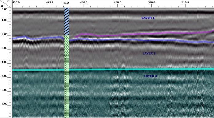
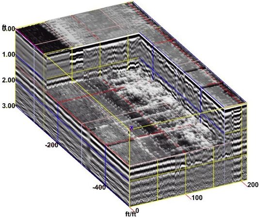
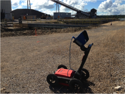
Ground Penetrating Radar (GPR) methods measure the changes in the propagation of electromagnetic energy in the ground to produce an image of subsurface conditions. The GPR signal is reflected when the electrical properties of the subsurface changes. A transmitting and receiving antenna are used to induce the signal and record the reflected data. The GPR antenna is pulled by hand or vehicle and can be viewed in real time. Data is collected digitally and be collected and processed to produce 2-D and 3-D images of the subsurface. Collier utilizes GPR on a variety of engineering and environmental applications.
Typical Applications of GPR Methods
- Buried objects (drums, USTs)
- Utility mapping & detection
- Clearing of boring locations
- Concrete & rebar assessment
- Voids
- Subsurface structures
- Waste pits, trenches
- Fractures, faults, & karst
- Archeology
- Forensics