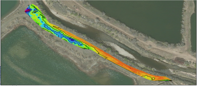
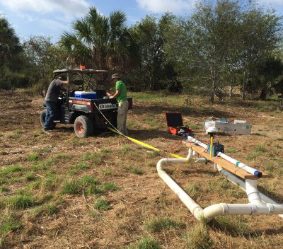
Electromagnetic (EM) methods measure subsurface conductivity through the use of low-frequency electromagnetic induction. EM instruments utilize a transmitter and receiver coil. Depth of exploration is a function of antenna frequency, separation, and orientation. Soil conductivity is a function of the electrical properties of subsurface materials and chemistry of pore fluids and is the inverse of electrical resistivity. Therefore EM methods are very useful in mapping changes in lithology. Additionally EM methods can also be used to detect and map buried ferrous and non-ferrous metal. Collier utilizes both Frequency & Time Domain EM instruments for various applications.
Typical Applications of Electromagnetic Methods
- Lithology mapping
- Contaminant plumes
- Boundaries of landfills & pits
- Metal detection
- Utility mapping & detection
- Ordnance UXO
- Lateral & vertical variations in soil
- Aquifer characterization
- Fractures, faults, & karst
- Dam & levee assessment