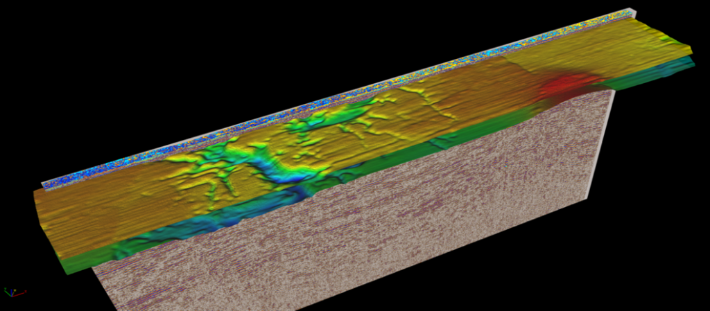
Collier specializes in the application of marine surveys for oil and gas exploration, geotechnical, civil engineering, offshore mining, near shore environmental, and other marine geologic mapping studies. Our team uses a variety of marine acoustic/seismic mapping and sub-bottom profiling systems, side scan sonar, marine magnetometer, and bathymetry survey systems. Survey methods are selected on the basis of target objective, water depth, resolution requirements, and environmental conditions. Expertise includes pre-survey planning and geophysical modeling, field support for data acquisition and operations, 2-D and 3-D data processing, interpretation, and image mapping.
Marine Applications
- Single & multi-streamer oil and gas exploration surveys
- 2-D/3-D marine multi-client seismic surveys
- Geologic formation mapping
- Seafloor mapping surveys
- Marine archaeological surveys
- Marine environmental site investigations
- Pipeline & cable tracking
- Marine UXO investigations
- Bottom hazards investigation
- Marine engineering & geotechnical studies
- Sediment classification studies
- Hydrographic surveys
Geophysical Methods
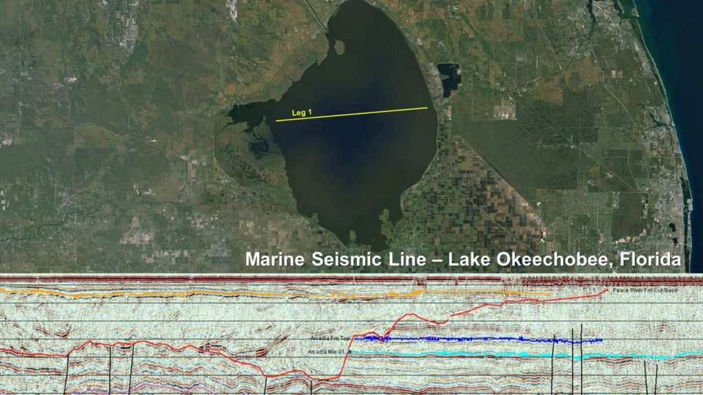
- 2-D/3-D High-Resolution Multi-Channel Seismic Streamer & Ocean Bottom Node Surveys
- Multibeam Bathymetry Surveys
- Side Scan Sonar
- High-Resolution Sub-bottom Profiling
- Marine Magnetometer Surveying