How About Walking Down to the Bottom of a Well With Your Bucket to Fetch Water?
Prepared by Andrew Stone, Hydrogeologist (andrewstonewater(at)gmail.com)
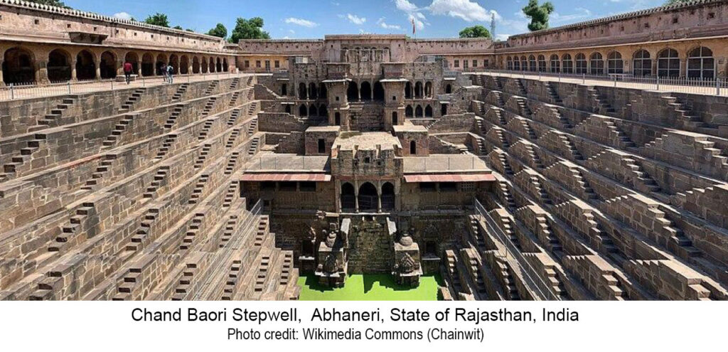
Did you know that there are over 3,000 stepwells in India with many others in arid countries? Water wells are typically constructed or drilled as simple vertical shafts. However, a stepwell is a large diameter excavation constructed to reach permanent groundwater. Access to the wellwater is via a series of stone steps down from the surface to the well water. At a time of low groundwater, it takes several staircases of steps down to reach the water level.
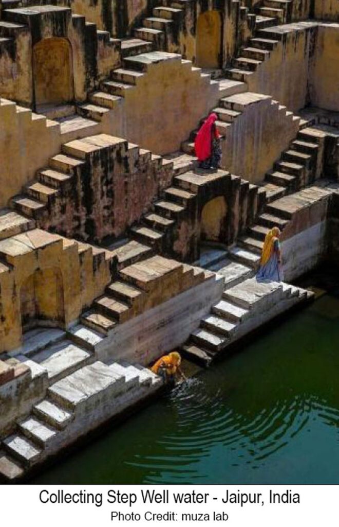
Locally known in India as baoli, the primary purpose of stepwells is to provide year-round availability for water, especially in arid and seasonally arid areas. To make groundwater available year-round stepwells are excavated to a depth just below the lowest expected groundwater level (water table). Steps in a series
of staircases allow people to walk down to reach the water. As the groundwater level rises in the well,
(in India, often as a result of seasonal monsoon rains) the lower steps become submerged and less staircases are used to reach the water.
The picture above shows the 100 ft deep Chand Baori stepwell. (The green color is the water!). The well was constructed in the 8th and 9th century and has a total of 3,500 steps in thirteen levels of stone staircases.
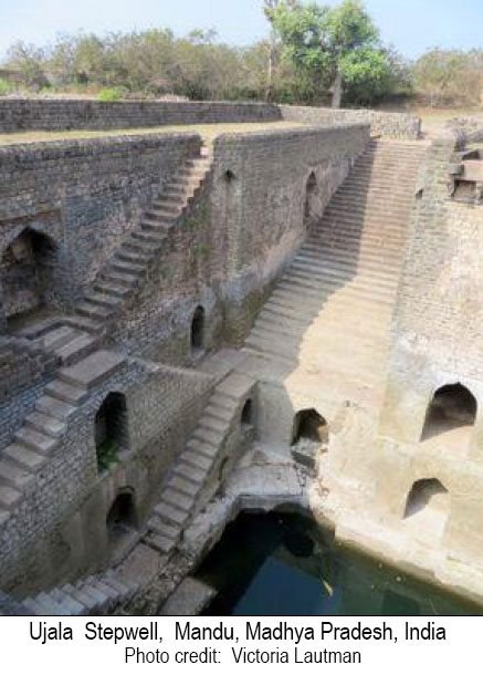
The picture on the left is of the 15th/16th century stepwell called Ujala. It has a less-complex design than Chand Baroi but operates on the same principle.
Stepwells had the primary secular purpose to supply water. However, over the centuries many took on additional significance that led to elaborate architecture and carvings to honor different religions and to give recognition to the dynasties and sultan rulers who financed the stepwell projects.
Still on the subject of history, during the 19th century when India was part of the British Empire, stepwells were decreed by colonial authorities to be unhealthy, and water supply was provided by drilled wells. Many stepwells were then closed and some were filled in, fell into disrepair or became dumps.
Fast forward to the 21st century, and with increasing population, increasing aridity and monsoonrain uncertainty, water managers in India have to consider all options. Many stepwells in India are now being cleaned out and recommissioned to augment supply sources. For example, groundwater is now restored as a supply source at stepwells in Jodhpur (Toorji ka jhalra stepwell) and in Rajasthan, (Moosi Rani Sagar stepwell).
Search the web for many sources of more information about these fascinating constructions that access groundwater. Wikipedia is a good starting point. Also, visit Stepwell Atlas for an interactive map of world stepwells. [Note – the two stepwells listed in the United States don’t function as traditional stepwells!]
Picture of the month prepared by Andrew Stone, Hydrogeologist, (andrewstone @ gmail.com)
HAND PUMP WITH NO HANDLE? A LEARNING OPPORTUNITY FOR THE WORLD
In 1854, in Soho, London – a pump handle was removed from a public water-supply well. Dr. John Snow has entered the history books because his detective work identified the contaminated public well as the source of a cholera outbreak. To prevent further infections, he had the authorities remove the pump handle to stop citizens from using the well.
In the mid 19th century, London, England, was a rapidly growing metropolis of over 2.5 million, with overcrowding, widespread poverty, and lack of sanitary services. With streams and ditches highly polluted, thousands of shallow wells were the only public water supply for many areas of London. Sewer systems were just developing, but cesspits served for most wastewater disposal. Outbeaks of cholera were common. At that time it was thought (incorrectly) that diseases were spread through the foul-smelling air in a process known as miasma.
In introductory classes, today’s students of public health, groundwater and water supply programs worldwide learn about the 1854 cholera outbreak in Soho, where 600 people in a small area died from cholera in just a few days. For groundwater specialists in particular, the case study of the outbreak is a classic lesson in contamination risk. The “detective work” by Dr. Snow who lived near Broad Street, (and who, incidentally, was a physician to Queen Victoria) identified the source of water contamination and the well pump handle was removed to prevent use of the unsafe supply. His work also provided clear evidence that ingesting cholera-contaminated water was the cause of the cholera outbreak, and he helped disprove the theory that miasma caused disease.
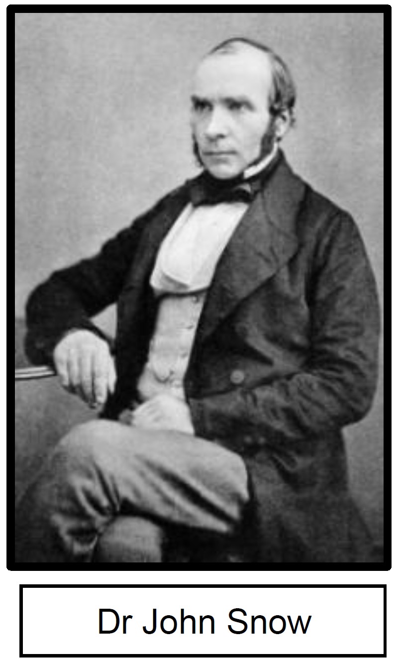
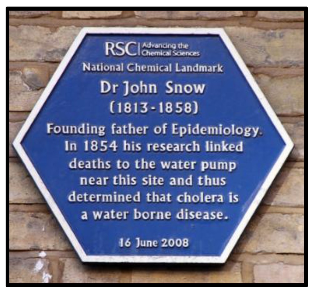
Dr Snow and local priest Henry Whitehead mapped homes where people had died. They identified that virtually all the cholera victims used the Broad Street pump for water. People in the same area who accessed different wells or who purchased water from water companies were not affected. Further investigation narrowed the origin of the August 30th outbreak to the death three days earlier, of a cholera infected five-month-old child, Francis Lewis at 40 Broad Street. The baby’s mother had washed the soiled diapers (also known at that time as tailclouts) from the cholera-infected baby and dumped the dirty water in a shallow cesspit. The crumbling cesspit brickwork was found to be just 2 feet 8 inches from the well, with the well water level just 8 feet below.
During the 19th century thousands of dug wells were needed for the rapid growth of London’s population. The geology below London comprises thin layers of sand & gravel, maybe up to 25 feet, overlying 150 to 200 feet of Eocene London Clay below which are aquifers with high quality groundwater in Cretaceous Chalk that underlies the whole London basin. Some of the “safe” water supply identified during the Broad Street cholera outbreak came from private water companies that sourced groundwater from chalk aquifers discharging as springs in Hertfordshire 40 miles north of London. The spring water was delivered to the city by canal and then by hollowed-out elm log pipe systems. That groundwater supply source in Hertfordshire continues to be part of London’s current water supply (but not via hollowed out logs!).
The Broad Street pump story provides us with basic lessons about wellhead protection and the critical importance of investment in urban sewers, water supply systems and properly constructed wells. [It is sad that today, 170+ years later, millions of people endure unsanitary conditions in slums and refugee camps in many parts of the world where the status of sanitation and water supply is reminiscent of London’s 1854 Broad Street.]
More information:
More information: Wikipedia Link
Other Research: Link to interesting research by Dave Boylan about Baby Francis Lewis
Picture of the month prepared by Andrew Stone, Hydrogeologist, (andrewstone @ gmail.com)
In the old days, geology surveys were carried out slowly and laboriously via the “soles of geologists’ boots.” Times and technology have changed. Adapting land-based methods, airborne geophysical exploration to map geology and hydrogeology has now gained rapid worldwide acceptance.
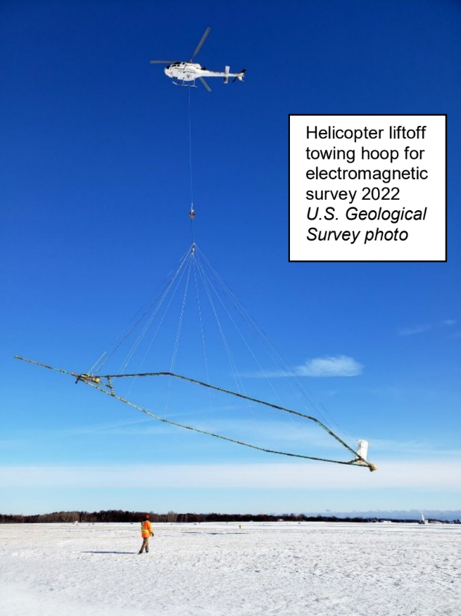
The photograph shows a helicopter carrying an airborne electromagnetic induction sensor over northeastern Wisconsin as part of a 2022 study to map aquifers. Data from the survey were used to create and refine models of water availability for Wisconsin’s resource managers and policy makers. The project was a collaboration by the U.S. Geological Survey and several Wisconsin state agencies.
By digitally mapping the subsurface from the air, airborne geophysical surveys by drone, helicopter or plane can rapidly provide high-resolution comprehensive subsurface information for geological, geotechnical and hydrogeological applications. Airborne survey data can be collected without ecological disturbance, disrupting agriculture or negotiating access to private land. Additional benefits result from access to inhospitable terrain and avoiding the logistics of adverse weather conditions for ground crews.
In 1855, back in the mid-19th century, Gaspar Tournachon patented the idea of aerial photographs for surveying. Early photography from hot air balloons showed the benefits of a “birds eye view” perspective of the earth. First adopted for mapping and military intelligence, use of an “eye in the sky “photography had many applications from the mid-19th to the mid-20th century.
Airborne geophysical surveys (mostly for oil and mineral exploration) began 70+ years ago after the Second World War and became “routine” in the late 60’s with increasing technological innovations for surveys of the electrical properties of the earth. In selecting the line of direction to fly surveys, operators need to account for direction of the Earth’s magnetic field in the target area and the orientation of known geological features related to the survey’s objectives. Airborne instruments are typically more sensitive than ground-based geophysics equipment because of the increased distance of the airborne signal from the land surface and subsurface under investigation.
Airborne geophysics digital data collection has huge time-saving cost benefits. By calibrating (ground truthing) airborne spatial data to existing borehole logs and geological maps, experts can identify groundwater aquifers, zones of water pollution or high groundwater salinity, determine how geology influences an aquifer’s three-dimensional geometry, select favorable areas for additional land-based assessment and select drilling sites to optimize the chances of successful wells.
Modern airborne geophysical surveys with various transmitters and receivers typically measure Earth’s magnetic field, naturally occurring gamma radiation and electrical conductivity. In addition, the tennis court-size platform arrays carried by helicopters, as shown in the USGS photograph, will probably also carry altimeters, video cameras and global positioning equipment.
Airborne geophysics surveys of the ground and subsurface are now one of the main tools in the geologists’ and hydrogeologists’ toolbox. With demographic pressures, changing weather patterns, and finite (although potentially renewable) water resources, accurate scientific resource assessments are crucial as the basis for water management decisions and the political prioritization of water allocation at local regional, national and global scale.
More information:
Wisconsin Survey (4 minute video): Southern Wisconsin Airborne Electromagnetic Survey 2022 | U.S. Geological Survey
Gaspar Tournachon: History of Aerial Photography
Airborne Geophysics:
https://colliergeophysics.com/airborne-geophysics/
https://csegrecorder.com/articles/view/the-application-of-airborne-geophysics-for-water-exploration
https://www.bing.com/videos/riverview/relatedvideo?q=+airborne+geophysics+for+groundwater+applications&mid=511DED9A46ACDCD923C5511DED9A46ACDCD923C5&FORM=VIRE
We have got another full line up of conferences for the month of April, check them out!
Clemson Hydrogeology Symposium – April 3-4 in Clemson, SC
Geology Techfest OSU – April 4-5 in Stillwater, OK
SAME San Antonio Post SBMRF – April 9-10 in San Antonio, TX
SAGEEP 3rd Munitions Response Meeting – April 13-17 in Denver, CO
AGWT-NCAAR Groundwater Conference – April 22-23 in Memphis, TN
ORWA Annual Conference – April 23-25 in Tulsa, OK
AIPG Texas GEODAYZ 2025 – April 25-26 in Stephenville, TX
Picture of the month prepared by Andrew Stone, Hydrogeologist, (andrewstone @ gmail.com)
The basic mechanism of ground surface subsidence is the compaction of sediments resulting from groundwater depletion in the aquifer(s) below. Aquifers with layers of fine-grained sediments are particularly vulnerable because they become compressible when dewatered by groundwater pumping. When water in the sediment pore spaces is removed, compaction may occur resulting in the clay layers occupying less space. Over time, and in places where there are thick aquifers with fine-grained layers, the compaction is transmitted upwards to the surface. Much of the damage from cracks and fissures on the surface to buildings, roads, canals, aqueducts, pipelines and well casing, results from uneven subsidence with differential vertical displacement causing sideways movements. Subsidence in coastal zones can greatly increase flooding risks. Pumping-related subsidence is not likely to occur in aquifers with mostly sandy sediments or in consolidated rock aquifers. It is the draining of water from saturated fine silt and clay layers that is the main subsidence culprit.
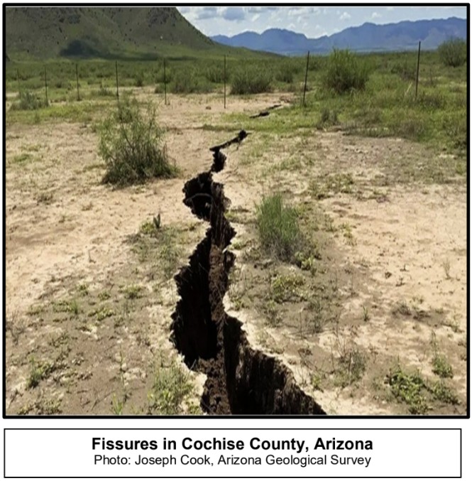
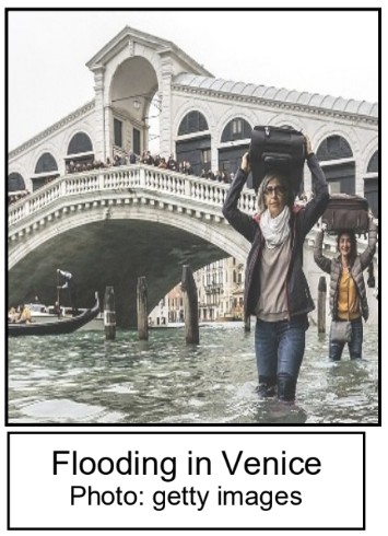
Groundwater-pumping-induced land subsidence is a worldwide phenomenon, not just in agricultural areas such as California’s Central Valley, but also in urban areas, for example, Mexico City, Mexico; Jakarta, Indonesia; Shanghai, China; Tehran, Iran; and Venice, Italy. The case of Venice serves to illustrate some of the cause and effect of pumping and the geological characteristics of aquifers where subsidence may occur.
Geologically, the 1,000-meter-thick layers of sediments beneath the Lagoon of Venice, where the City of Venice is situated, are Pleistocene-Holocene sequences of sands and silts deposited by rivers flowing southwards from the Alps. The original settlement of Venice was on small sandy islands in the lagoon surrounded by mud flats. Expansion of the city occurred by reclaiming and filling areas of the lagoon tidal flats.
During industrialization in the early 20th century, a manufacturing complex was built near Marghera on the edge of the Venice Lagoon. Groundwater pumping from the Quaternary aquifer to supply the industries resulted in subsidence extending beneath Venice City. Most pumping occurred between the 1930s and 1970s but subsidence continued even after pumping was curtailed. This anthropogenic-caused subsidence, added to rising sea levels and longer-term small increments of natural geologic subsidence has led to alarm and worldwide concern for the flood-compromised future of this famous heritage city.
Gravity-flow of water in the California Aqueduct is crucial to delivering water for irrigation in the Central Valley. However, according to the California Department of Water Resources, the volume of flow in the aqueduct, or hydraulic conveyance capacity, has been reduced by more than 40% because of subsidence from groundwater pumping and now requires a multi billion dollar solution.
According to the US Geological Survey, “…more than 80 percent of the identified subsidence in the USA has occurred because of exploitation of underground water, and the increasing development of land and water resources threatens to exacerbate existing land-subsidence problems and initiate new ones.”
More information:
Every month Collier sends out employees all over to several conferences, see below to find out if you can catch us at any!
Geotechnical Frontiers – March 2-5 in Louisville, KY
Carbon Capture, Utilization, and Storage – March 3-5 in Houston, TX
Texas Desal Legislative Workshop – March 4 in Austin, TX
Texas Water Association Annual Conference – March 5-7 in Austin, TX
TMUA Utility Leadership and Management – March 6-7 in Waco, TX
3D Seismic Symposium – March 6 in Denver, CO
USACE Sacramento District Business Opportunity – March 11 in Sacramento, CA
Texas Water – March 18-21 in Houston, TX
AGWT Washington – March 18-19 in Spokane, WA
SAME Industry Day – March 18 in Fort Worth, TX
Congratulations to Phil Sirles on his well-deserved retirement after an impressive 40+ year career in the engineering geophysics industry. Since joining Collier in 2018 as a Principal Geophysicist, Phil has made lasting contributions to the field. His leadership and expertise have left a remarkable legacy. We wish him a joyful and rewarding retirement ahead!
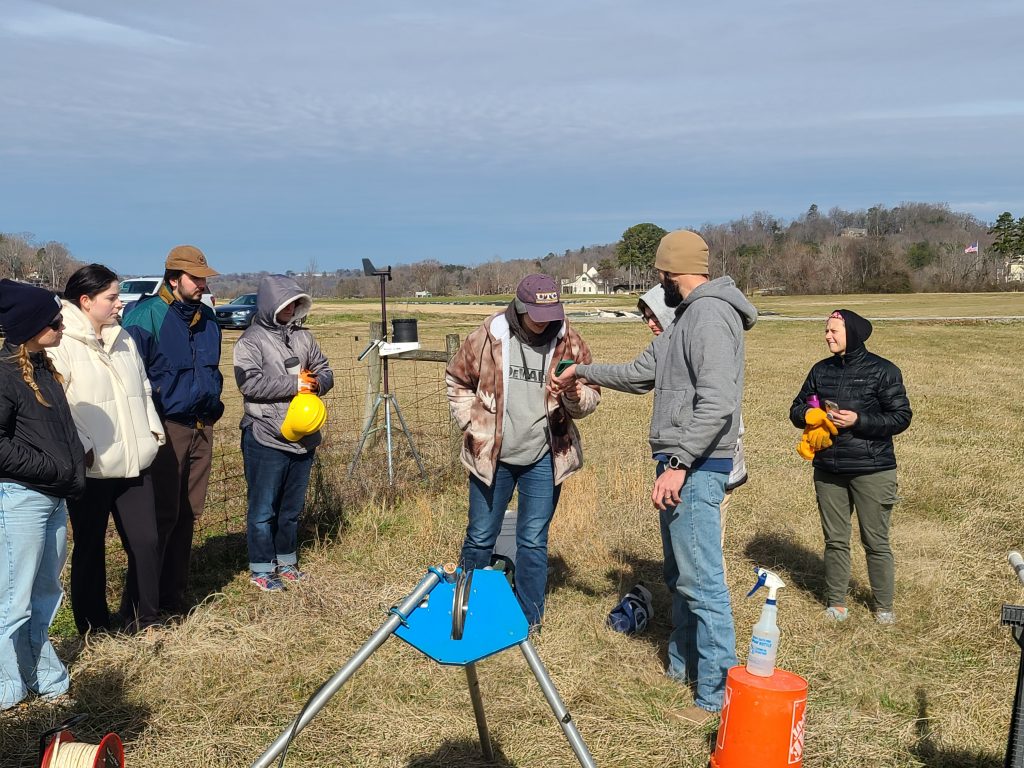
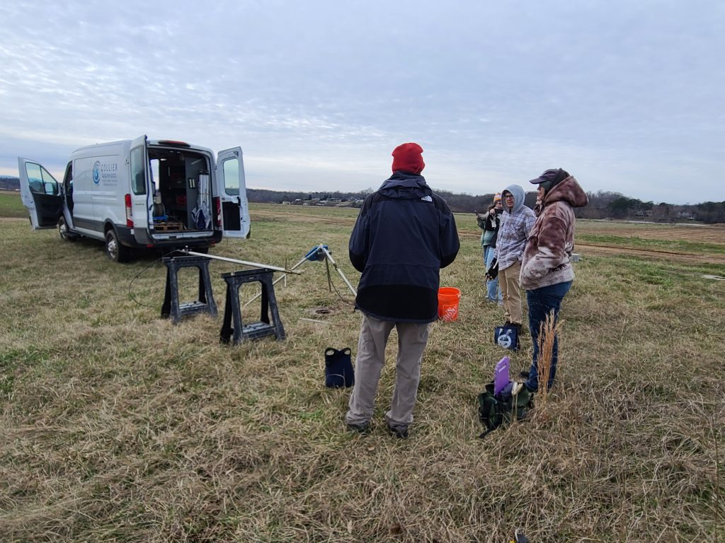
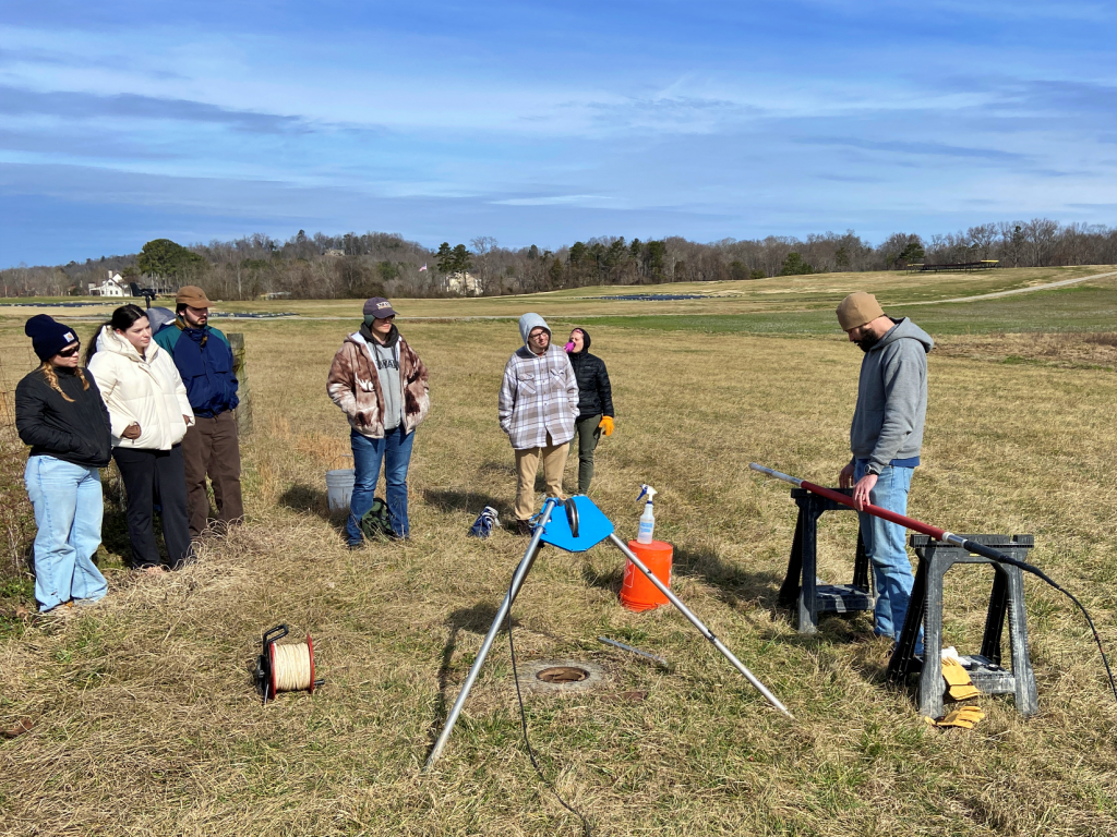
Collier’s Nicholas Rebman recently conducted geophysical logging in multiple boreholes at the University of Tennessee, Knoxville‘s Research Farm. This was hosted by their own Dept. of UTK Earth, Environmental, and Planetary Sciences to give students a firsthand look at this important technique that makes a detailed record of the surrounding geological formations.
Special thanks to Amelia (Amy) Robinson and Kevin Hon, P.G. (UT Chattanooga) for the opportunity!

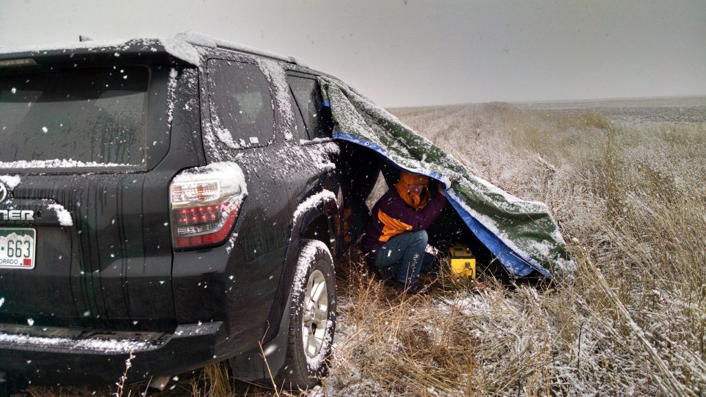
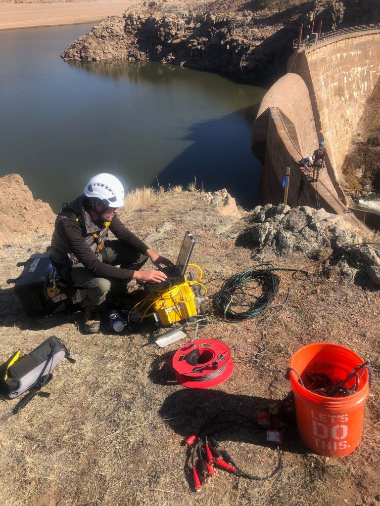
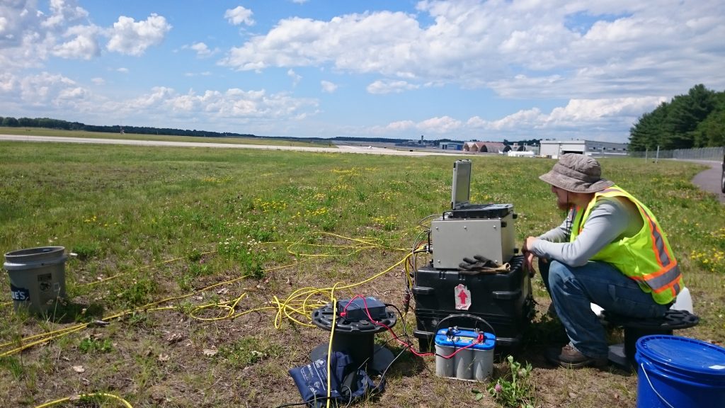
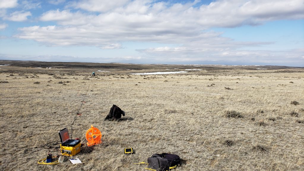
Our field crews find themselves making some interesting setups in cool places when they are on the go!

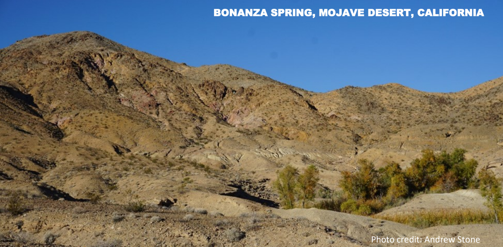
In the age of steam locomotives in the US, from the mid 19th to the mid 20th century, water was a critical need. The availability of water from springs was often a determining factor influencing routes of railroads in desert environments. Surveyors seeking water sources often worked years ahead of rail line construction because routes had to follow water availability. Steam locomotives could use up to 150 gallons of water per mile and required frequent stops to “fill-up.”
Bonanza Spring is the largest spring in California’s Mojave Desert. Located in the foothills of the Clipper Mountains it emerges from bedrock as a perched spring disconnected from the basin-fill aquifer systems in the desert valleys hundreds of feet below. The spring is at an elevation of 2,105 feet above sea level. According to historical records, and current measurements, the spring flows at a fairly constant rate of about 10 gallons per minute. In stark contrast to the dry surrounding landscape, vegetation where the spring emerges (photo) includes mesquite, cottonwood trees, and cattails. In addition to serving as a water source for creatures such as desert bighorn sheep, desert tortoises and jackrabbits, the spring is habitat for frogs, toads, catfish and bluegills. (Separated from the nearest permanent surface water sources by many miles and great elevation difference: how did fish get there and when?)
19th century railroad engineers configured a 5 mile long, 2 inch diameter steel pipeline from Bonanza spring to intersect the proposed route of the rail line. The tiny community of Danby (now a ghost town) was built in 1883 at the end of the pipeline as a water stop on the Atlantic & Pacific Railroad, (760 feet lower in elevation than the spring). By 1887 the rail line between Chicago to Los Angeles was completed, with the Mojave Desert section dependent on piping water from mountain springs such as Bonanza. In the early 20th century the spring supply piped to Danby was augmented by groundwater from wells drilled next to the rail line.
The Bonanza spring story is just one example of how groundwater from wells and springs played an important role in the development of America’s transcontinental rail roads in areas where permanent or seasonal surface water sources were not available for steam locomotive “fill-up” stops.
More information
Spring hydrology: https://www.tandfonline.com/doi/full/10.1080/15275922.2018.1448909
Danby: https://www.trailsendpublishing.com/blog/danby-a-condensed-history
Locomotive water consumption: Water stop – Wikipedia