

July 21, 2026
Irrigation, Declining Groundwater — San Luis Valley, Colorado
Regional drought, less winter snowpack, less snow to melt, less aquifer recharge, aquifer depletion, groundwater quality deterioration, water rights complexity, pumping management dilemmas!
Prepared by Andrew Stone, Hydrogeologist (andrewstonewater(at)gmail.com)
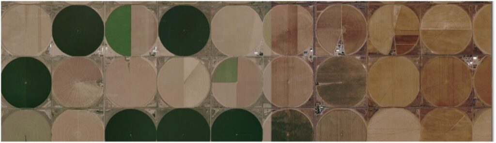
In many parts of the world there are water management challenges related to climate change and groundwater pumping in excess of recharge. The San Luis Valley in Colorado is one such area. Other states, such as California, Nebraska and Arizona have irrigation areas with similar challenges of supply & demand mismatch.
The San Luis Valley with an average elevation of 7,000ft above sea level has a cold desert climate with annual precipitation below 8 inches. Prior to settlers arriving in the Valley in the mid-19th century the Kapota band of Ute Indians lived in the Valley. Early settlers recognized irrigation potential and developed stream-fed systems for agriculture. By the 1880s, water conflicts among settlers were occurring and in 1888 there was a General Adjudication of water rights. By the end of the 19th century all the surface water rights had been appropriated. The 8,000 square mile Valley has two major groundwater aquifer systems that have been developed for productive commercial agriculture. By the 21st century declining groundwater levels were causing increased challenges for water management. In this third decade of the century, the declining water availability for irrigation has become more dire.
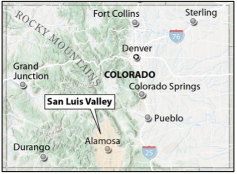
Geologically, the San Luis Valley is a downfaulted structural basin. There are confined and unconfined aquifers in sediments filling the basin. Between five and one milion years ago the valley contained Ancient Lake Alamosa. Thick layers of sand, gravel and clays developed in the lakebed, and those sedimentary deposits, now identified as the Alamosa Formation, contribute to the hydrogeological complexity of parts of the confined aquifers. The upper unconfined aquifers are separated from the lower confined aquifers by these clay layers. Streams flowing from the surrounding Sangre de Cristo and San Juan Mountains are the principal source of groundwater recharge with spring snowmelt sustaining the streams. Groundwater in the confined aquifers is under pressure, but it was only in the early years that there was artesian flow that reached the surface. tion.
The Rio Grande River flows through the Valley, and diversion ditches have long been a source for irrigation. Groundwater naturally helped sustain river flow, and excess irrigation water from inefficient flood irrigation helped recharge the aquifers. In the 1950’s rural electrification programs and high capacity pumps increased pumping and decreased the volume of groundwater. A 1969 state law required the State Engineer to integrate administration of groundwater and surface water rights to protect senior water right holders. As a response to declining groundwater levels, in 1972 the state declared a moratorium on new wells in the artesian aquifer followed by a 1981 moratorium for new wells in the unconfined aquifer. In 2004, a law was passed (SB04-222) ordering that aquifers in the Valley must be managed for sustainability. An added complexity is that the Rio Grande River is subject to an interstate water sharing compact.
The establishment of local control via groundwater sub-districts was a strategy of SB04-222 designed to achieve agreements on reducing Valley pumping by 20%. Many areas do not have detailed records of past irrigation use. Groundwater pumping metering only began in 2009, and groundwater aquifer models have been used to characterize the aquifer dynamics and quantify needed pumping reductions. Protecting water rights and also maintaining faming viability has led to legal issues among landowners, districts and the state. There are ongoing endeavors to take land out of production to achieve sustainability. “Buy and dry” efforts have made use of use federal programs such as the Conservation Reserve Enhancement Program. Provided there are funds available, recent pioneering initiatives to retire crop circle irrigation by conservation easements may help towards sustainability.

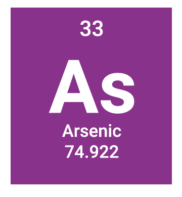
Heavy metals, such as arsenic, uranium, tungsten, and manganese, occur naturally in Valley aquifer sediments. Drilling deeper wells closer to bedrock where heavy metal concentrations may be higher, and having less recharge water available to dilute contaminants has resulted in elevated levels in some wells. Arsenic in irrigation water can stunt crop growth but the main concerns are the negative socioeconomic impacts of contamination in private wells where levels exceed health thresholds.
Worldwide there are groundwater problems because of over pumping and climate change impacts on recharge. San Luis Valley is a representative case study of political and economic challenges resulting from developing groundwater beyond sustainability. Using good science to quantify the geometry and hydraulic characteristics of aquifers is a perquisite for resource management. Achieving agreement among groundwater professionals, landowners, irrigation districts, local government and state regulators about cause and effect, and implementing equable effective solutions, is a Herculean challenge that should be front and center of water policy.
BIG PIVOS: 21st Century Realities Hit San Luis Valley Agriculture | San Luis Valley background
San Luis Valley Drinking Water Heavy Metals Explained - Circle of Blue
Easements for Aquifer Rcover in the San Luis Valley